Geospatial Support
We specialize in remote sensing projects, particularly for forestry applications. However, we are capable of accommodating some GIS requests or other geospatial projects. If we can help, we will!
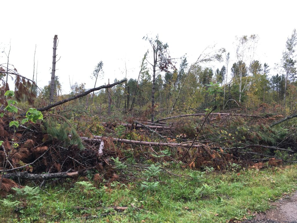
Storm and Fire Damage Mapping
Windthrow, tornadoes, hurricanes, derechos, hail, ice, and fire – we’ve mapped them all!
Most damage from these causes can be mapped in a few hours with freely available imagery when it becomes available. This is one of the most affordable services we provide.
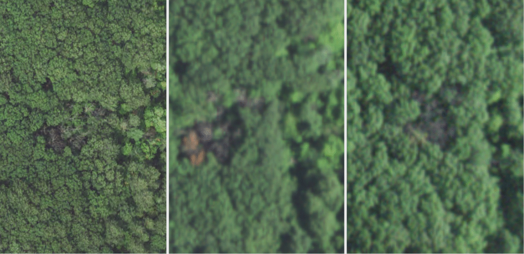
Insect and Disease Mapping
An alternative to aerial survey, aerial imagery is used to locate areas that may warrant concern. In some cases, we may be able to provide an assessment of the cause (such as oak wilt, featured in this set of images). This service is especially useful for those with a large amount of area to manage, but without the ability to survey it all by foot. Able to be completed using freely available aerial imagery or high-resolution satellite data, this service can tailored to meet specific needs.
Special Projects
Have something unique? Ask us!
We’ve supported various projects and at different stages. We will always be honest with you about what we think is realistic with remote sensing and GIS capabilities, and the data that is available to support your projects. We would love to help!
A Note on Pricing
Every project is different, and the time that goes into each one is only what is needed to produce a quality product. That said, we understand that it is helpful to get a “ballpark” idea of what costs may be before contacting us. For reference, most large, severe disturbances, such as from storms, can be mapped for less than $1000. Basic survey work for parcels less than 500 acres will generally range from $300 to $500.
As the difficulty and required resources of a project increase, the prices will go up proportionally. However, prices will always be clear and we will never surprise you with hidden fees or costs.
Initial consultations are FREE.
Let Us Help!
Initial consultations are FREE! No obligations, no spam, just answers.